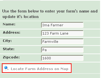
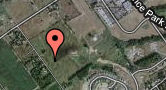
After entering the Farm information, click on "Locate Farm Address on Map" to locate your farm.
This will place a marker on the map. If the location is not
correct, you may left click on the marker ![]() , hold the
mouse button down and move the marker to the correct location. Place
the marker in the center of the farm. You may want to turn on the satellite
images to help you locate your farm. Once you moved the marker to
the correct location, click on the “Save” button under your farm information.
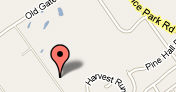
, hold the
mouse button down and move the marker to the correct location. Place
the marker in the center of the farm. You may want to turn on the satellite
images to help you locate your farm. Once you moved the marker to
the correct location, click on the “Save” button under your farm information.
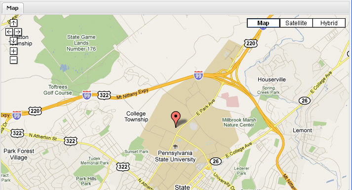
![]() streets and roads
streets and roads ![]() aerial view
aerial view ![]() combines map and satellite
combines map and satellite
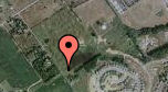
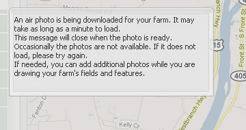
After saving, you will be leaving the google satellite image and downloading air photos from PASDA (clearing house for aerial images hosted by the Pennsylvania State University). You will notice that your computer screen will fade out and a box will pop-up explaining the downloading process and waiting period. After downloading is complete, your screen will restore to the original brightness.
![]()
To proceed onto the next step click on ![]()