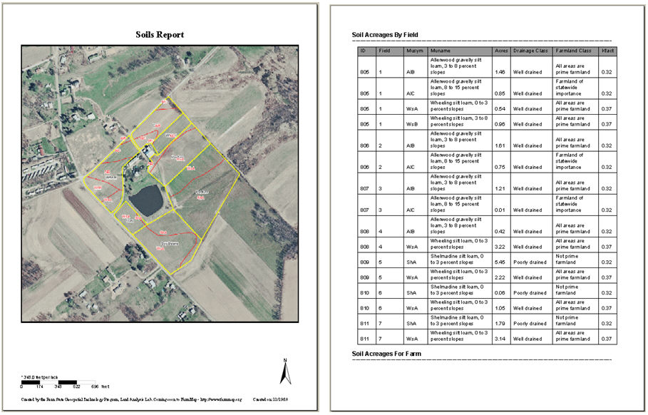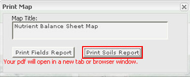
Selecting the "Print Soils Report" in the "Print Map" window will give you the message that a pdf will open in a new tab or browser. At this time, a report is being created identifying soil type and size within each field drawn on your map. Other information provided in this report is soil description, drainage class, farmland class and K-factor.
The first page of the report will be a map of the farm you digitized with an aerial image in the background, there will also be a scale bar and north arrow. The following pages will provide you with a table of Soil Acreages By Field.