

Welcome to PAOneStop!
*Start Mapping Using PAOneStop Now
(PAOneStop is optimized for Mozilla Firefox.This is a free download. Get firefox now.)
6 Easy Steps to Generating a Farm Map PAOneStop
1. Create Login
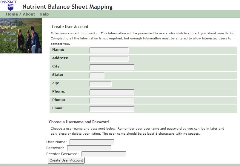
- Login to PAOneStop and create an account with a secure username & password
- Locate farm using address and Google Maps
- Develop maps for as many farms as you wish!
2. Locate Farm
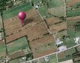
- Locate farm on a map using Google Maps!
3. Locate & Label Fields

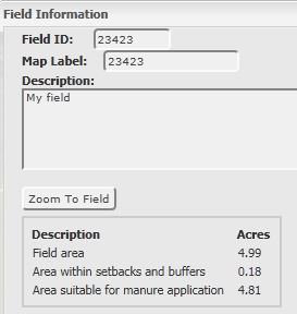
- Outline field boundaries, assign field identification number
- Describe fields.
- Calculate field acreages automatically
- Edit, add or delete fields as needed
- View aerial photography automatically provided for you, for your farm!
4. Draw Farm Features
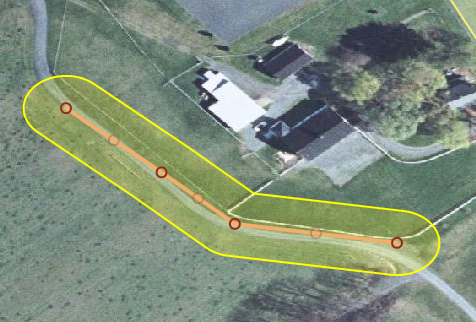
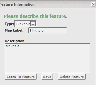
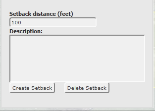
- Draw other farm features needed for map (water wells, sinkhols, streams, manure staging areas).
- Generate manure setback areas & stream buffers.
5. Select Field to Map
- Select features to appear on your map. Only impacted fields need to be mapped.
- Hide any field of feature not needed for map. Select map background (aerial photograph or topography)
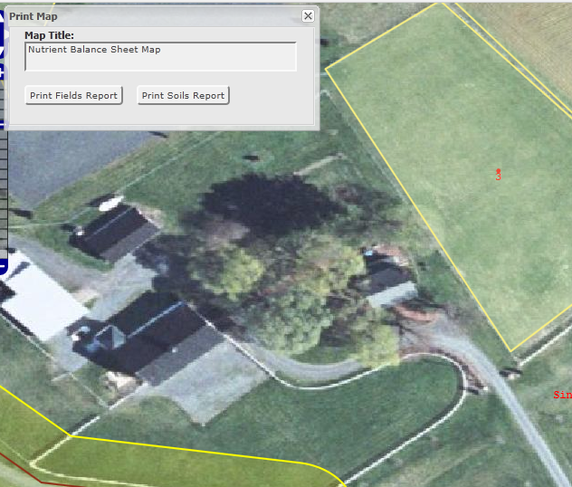
6. Create Digital or Hard Copy Maps
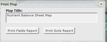
- Generate maps that are acceptable for a PA Nutrient Balance Sheet submission.
- Save maps and data securely online for future reference & mapping.
- Draw fields and farm features once - all data area saved in a secure database that you can access at any time using your login information.
 The PA Nutrient Management System was created by the Penn State Geospatial Technology Program, Land Analysis Lab. Copyright 2011. The