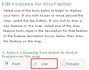
The "Draw Line" tab will allow you to designate areas on the map that can be represented by a line, such as roads and streams.
To draw roads or streams, select the “Draw Line” tab, place your cursor on the location of the feature and trace the feature by left clicking. With each left click of the mouse you will place a vertex (a point that will lock the line in place) that will allow you to change directions of the line. Continue tracing the feature and double left click to finish the line.
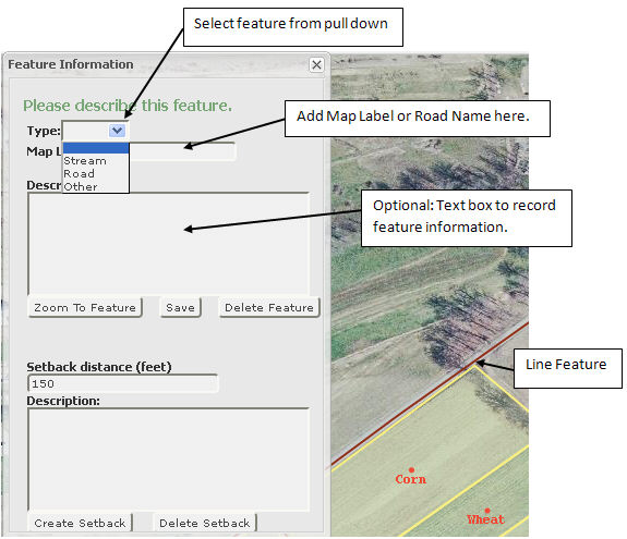
Double left click will finish drawing the line and open the Feature Information box. Choose the type of feature from the drop down list, add map label or road name and a description (optional) and save the feature. After saving the feature, you can add a setback and vegetative buffer to a stream. Close the "Feature Information" window before proceeding onto the next feature.