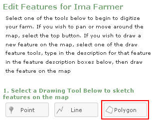
The "Draw Polygon" tab allows you to draw features that are represented by three or more sides and have an area (the same as drawing a field).
This tool is also used to extract areas from existing farm field(s) that you have created.
To begin drawing a polygon feature, select the "Draw Polygon" tab then place your cursor on the map where you would like to begin mapping your feature. Begin drawing by left clicking with the mouse. With each left click of the mouse you will place a vertex (a point that will lock the line in place) on the photo. Drag your mouse along the edge of the feature and left click again. This will place another vertex which will allow you to move the line in a different direction so you can continue to trace the boundary of the feature. Continue this process until all edges of the feature are enclosed, then double left click to finish.
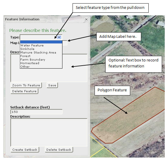
When you double click to finish the polygon feature, a “Feature Information" box will open. Choose the type of feature from the drop down list, add a map label and a description (optional) and save the feature. After saving the feature, you can add a setback. Close the "Feature Information" window before proceeding onto the next feature.