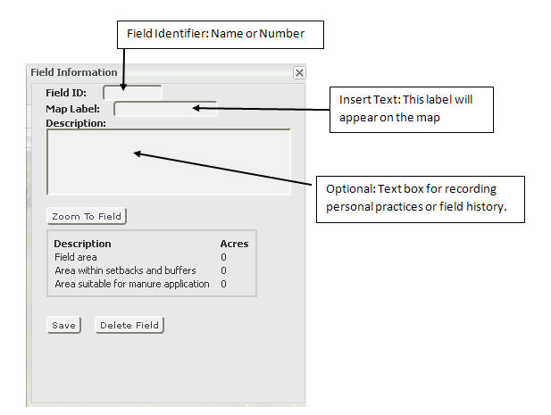
Field Information Window
Field Information window allows you to name or number and record information
about a specific field. This box also provides you with acreage information
about the field, such as field area, area within setback and buffer zone
and suitable acreage for manure application.
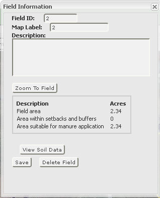
"View Soils Data" tab
will be available in the "Field Information" window only after
the field has been saved.
- Enter the field name or number in the "Field ID" box,
enter the name in the "Map Label" that you would like to
appear on the map, then type in the description of the field in the
"Description" box (optional).
- "View Soil Data"
tab allows you to view soils information for the selected field.
- "Zoom To Field" by clicking
on this tab. The selected field will zoom in and will be centered
in the middle of the map.
- "Delete
Field" tab, when selected will remove the selected
field from the map and all related information.
- To continue on to your next field you must click the "Save"
tab in the "Field Information" window and then close the
window.
- After each field is saved, a "Farm Field Table"
will be created providing field identifier and acres information.