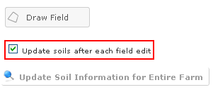
Soils information is provided for each field that is digitized. You will be able to obtain the following information: map unit and size, drainage class, farmland class and K-factor. Under the "Draw Field" tab, you will see the option to "Update soils after each field edit". By default, this is turned on. After each field is digitized the soils information is automatically retrieved. To speed up the digitizing process, you may un-check the box in front of "Update soils after each field edit." When you are finished digitizing the entire farm, you can click on "Update Soils Information for Entire Farm."
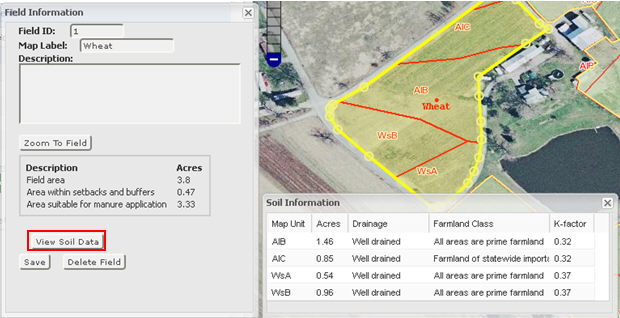
To access the soils information, select a field that has been digitized. This will open the "field Information" box. Now select the "View Soil Data" tab. This will open the "Soil Information" box. To view the soil boundaries within the field, you must have soils overlay selected in the base layer window.