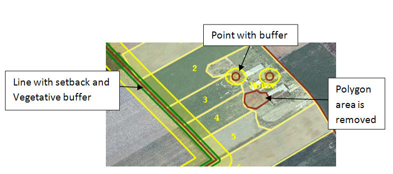
There are objects or features on your nutrient plan that need to be addressed as areas of concern, such as wells, sinkholes, water features and manure stacking areas. These are all areas that setbacks or buffers will need to be applied or removed completely from the mapping area.
There are three options for placing features on the map: points, lines and polygons. Once these features are created, you will be given the option to label, describe and apply setbacks or buffers. After features are created and saved, the area that is within the boundaries of the field that has been drawn on your map will be automatically recalculated to remove the feature and or the buffered area.